Indonesia Map
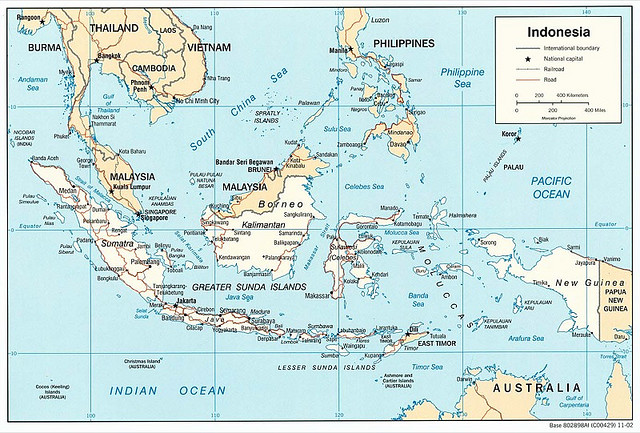
Indonesia is located between the Indian Ocean and the Pacific Ocean. On land, it borders Malaysia to the north, East Timor and Papua New Guinea to the east. On water, its neighbors are Australia, Palau, Philippines, Vietnam, Singapore, Thailand and India. Since it comprises many islands, sometimes it might become a challenge to recognize the country on the map.
Map of Indonesia
Here is a map of Indonesia, with cities and other details.
Obviously, this is a map for general reference. If you plan to drive in Indonesia, you’ll need a good , detailed driving map. You can purchase it once you arrive in Indonesia or you can download one from specialized sites. Make sure to buy a map of the island and/or region you are driving in, as it will be more detailed and the roads are marked properly.
When it comes to walking in the cities, as well as getting between the hotel and the sights, you’ll need a city map which you can pick up at the tourist centers or the hotel.
Here is an interactive map of Jakarta.